
In 2001, the firm was inspired to design a whole new map of Manhattan.
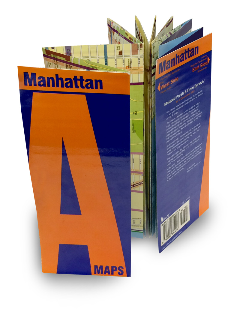
The Manhattan “A” Map
During the latter months of 2001, an Informing Design team could be seen driving a teal Camry around Manhattan. What were we doing? Meticulously taking note of unusual conditions pertaining to every street and every highway ramp on the island. Soon we managed to achieve our goal: a new street map of Manhattan that nailed, in detail, how every road and ramp works, how colliding street grids can resolve themselves into something comprehensible, and where to find virtually any amenity a visitor might need via a curated, easy-to-use index. Using our signature de-complexifiying mapping approach, we untangled the Financial District and Greenwich Village, made clear how the major north-south arteries suddenly change names on the Upper West Side, and highlighted how Broadway — the longest road on the island — sprouts mirror image streets on its western side in Lower Manhattan and gives rise to several “tributaries” on its eastern side. We also untangled every single ramp on and off every bridge and tunnel, along with the Henry Hudson Parkway on the west side and FDR Drive in the east. No consumer map of Manhattan had ever gotten all of this right. The printed version of the map consisted of a single long, narrow piece of paper, folded like an accordion (the inspiration for the map’s “A” name) so that the user could handily examine several dozen north-south blocks at a time without having to deal with complicated unfolding and re-folding. With the West Side on one side of the map and the East Side on the other, a simple flip was all that was needed to switch between the two. Available only in New York City, it sold out within a year.
Client: published by informing Design
Time Frame: 2001, redone 2008
Central Park, Untangled
Frederick Law Olmsted was famous for designing tangled trail systems in his parks. Central Park is famously full of such “rambles.” Where do you begin to think about untangling the park? It turned out that answering a key wayfinding question was the solution: what’s the best way to walk across the Park between the West Side and the East Side? There happens to be a discrete set of moments where doing so is optimal, and mapping these routes gave us the east-west lines for our “gridding” of the Park. For the north-south lines, we highlighted the paths that connect up and down from the east-west transversals to key locations within the park. Voila: Central Park Untangled.
Client: Informing Design
Time Frame: 2008
The Manhattan Subway Map Untangled
The Manhattan subway has an above-ground problem: the subway lines like to bounce around, first under one major north-south artery and then under another. To clarify what is happening, the firm designed a subway map that superimposes these major arteries over the subway lines so that the user never loses sight of the above-ground context of their travels.
Client: Informing Design
Time Frame: 2001, updated frequently