
A Less Embarrassing Map Kiosk
A funny thing happens when you put up a huge map kiosk in an area with lots of tourists: not a lot of them look at it. On a crowded weekend afternoon, I once spent an hour sitting on the Embarcadero in San Francisco watching people totally ignore a six-foot-wide by six-foot-high map. I also spent some time observing our own six-foot-high maps housed in giant kiosks along the ceremonial boulevard down from the Capitol in Nashville. The same thing happened: hardly anyone looked at them.
Is it that people are too embarrassed to stop and look like they need help?
Then we did something by accident. In Winston-Salem, budget constraints led us to drastically reduce the scale of the typical sidewalk map kiosk down to something we call the “personal map station” — a two-foot-wide map disc mounted on existing light poles and situated in natural little sidewalk “theaters” (corner bulb-outs and other such places where people could pause outside the stream of pedestrian traffic). Fabrication costs were less than $300 per map circle.
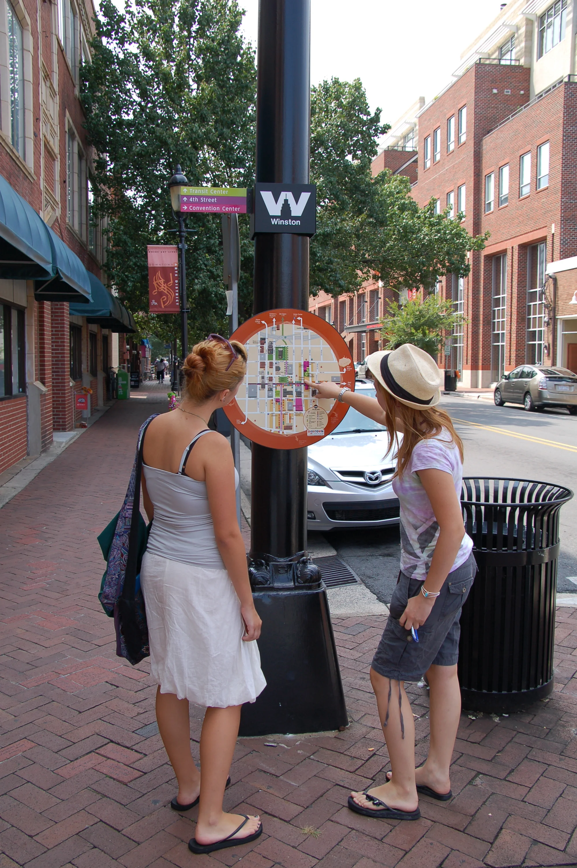
Passers-by checking out personal map station in Winston-Salem.
What happened next floored us. The contractor reported that his installers actually had to ward off folks who were trying to check the maps out even as they were being installed. As time went on, our clients claimed that they had never seen you-are-here maps attract such a continuous stream of attention. Passers-by didn’t hesitate to pause to get their bearings.
It may have helped that the maps were easy to use, each one custom designed for its specific location, using our 3-D model of Winston-Salem and oriented to the viewer’s direction. (See the “Reality vs. Reality Figured Out” case study for the story behind our 3-D maps.) But we suspect the main reason behind the maps’ popularity was not something we had planned for: an unobtrusive, “personal-sized” map simply works better than a massive monolith at engaging the passer-by.
Had we stumbled upon the less embarrassing map kiosk?
Nashville gave us the chance to see if the Winston-Salem experience was a fluke. We laid out a system of nearly 150 of these personal map stations in Nashville’s Downtown and West End/Vanderbilt area. Same size, same approach to placement, same custom-oriented 3-D maps at each location.
The result?
Ditto.
People paused, frequently, briefly scanning the maps and then moving right along. Yes, the maps need to be effective at getting across the news of where you need to head in a quick glance. But we also now have little doubt that they need to be “personal-sized,” too. You can’t hit people over the head with giant monolith maps. They apparently don’t appreciate it.
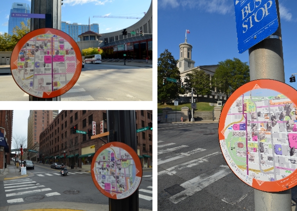
Personal map stations in Downtown Nashville
Our most recent map station installations have been in honor of the eclipse in Hopkins County, Kentucky; for the campus of Owensboro Community & Technical College (also in Kentucky); and for the Wythe County courthouse complex in Virginia.
Personal map stations, with "eclipsing" back to back maps, in Madisonville, Hopkins County, KY
Personal map station, Owensboro Community & Technical College campus, KY
Personal map station, Wythe County courthouse complex, VA